Q: When are the best times to experience fall foliage in the United States?
A: The prime viewing window for fall foliage in the United States typically spans from late September through late October. However, this varies significantly by region. Northern states and higher elevations see peak colors earlier, usually in late September to early October. Southern states and coastal areas often display their vibrant hues later, extending into late October or even early November. Always consult current Fall Foliage Road Trip Maps and local reports for the most accurate predictions for your desired destination.Q: What makes Fall Foliage Road Trip Maps essential for planning?
A: Fall Foliage Road Trip Maps are essential because they provide curated routes specifically designed to showcase the most vibrant autumn colors. They often include details on peak viewing times, scenic overlooks, charming small towns, and local attractions along the way. These maps help travelers efficiently plan their itinerary, avoid missing key highlights, and navigate unfamiliar areas with ease. They transform a regular drive into an optimized, breathtaking leaf-peeping journey, ensuring a memorable experience.Q: Which regions in the US offer the most breathtaking fall foliage drives?
A: The United States boasts numerous regions renowned for breathtaking fall foliage. New England (Vermont, New Hampshire, Maine) is iconic, famous for its fiery reds and golds. The Blue Ridge Parkway in North Carolina and Virginia offers stunning mountain vistas. In the Midwest, Michigan’s Upper Peninsula and Wisconsin provide beautiful autumnal scenes. For brilliant yellows, the Aspen groves of Colorado and Utah are unparalleled. Each region highlighted on Fall Foliage Road Trip Maps promises a unique and spectacular seasonal display.Q: Can I find real-time updates on fall color progression using these maps?
A: Yes, many modern Fall Foliage Road Trip Maps and related online resources offer real-time or near real-time updates on color progression. Websites from state tourism boards, national parks, and dedicated foliage trackers use satellite data, ground reports, and crowd-sourced information to provide up-to-date conditions. These interactive maps allow travelers to monitor current color levels in specific areas, helping them adjust their plans for optimal viewing. This ensures you catch the colors at their absolute peak.Q: What should I pack for a fall foliage road trip in 2026?
A: For a fall foliage road trip in 2026, packing layers is crucial due to fluctuating autumn temperatures. Include light jackets, sweaters, and a waterproof outer shell. Comfortable walking shoes are essential for exploring scenic stops. Don't forget a camera to capture the stunning scenery, binoculars for distant views, and a portable charger for your devices. Snacks, water, and a first-aid kit are also recommended. Consulting your Fall Foliage Road Trip Maps for regional weather variations is always a smart idea.Q: How can I avoid crowds during peak fall foliage season?
A: To avoid crowds during peak fall foliage season, consider traveling during weekdays rather than weekends, or plan your trip for slightly before or after the absolute peak. Utilizing Fall Foliage Road Trip Maps to discover lesser-known scenic routes and smaller towns can also help. Start your day early to visit popular spots before the rush. Exploring alternative viewpoints away from main tourist hubs often reveals equally stunning, more peaceful vistas. Flexibility in your schedule is a major advantage. Fall foliage map, best fall drives US, scenic autumn routes, leaf peeping guide, road trip planner, US fall colors, autumn travel planner, East Coast fall foliage, West Coast fall colors, fall foliage destinations, scenic byways autumn, fall color prediction mapsDiscover the magic of autumn with expertly curated Fall Foliage Road Trip Maps, your essential guide to America's most breathtaking seasonal displays. As 2026 approaches, travelers are eagerly planning their leaf-peeping adventures, seeking vibrant landscapes and memorable journeys. These maps offer detailed routes, peak viewing times, and hidden gems across the United States. Navigational tools make it simple to plot your course, ensuring you catch every spectacular vista. From New England's iconic reds and golds to the subtle beauty of the Pacific Northwest, preparing for your autumn escape is easier than ever. Find invaluable resources for an unforgettable visual feast.
- When is the ideal time to plan a Fall Foliage Road Trip for 2026? - The ideal time for a Fall Foliage Road Trip in 2026 will generally fall between late September and mid-October. Peak dates vary by region, with northern states seeing colors earlier. Consulting specific regional Fall Foliage Road Trip Maps for precise timing is recommended to catch the most vibrant hues across the US landscape.
- What makes a Fall Foliage Road Trip Map different from a regular map? - A Fall Foliage Road Trip Map is specifically curated to highlight routes and locations renowned for their autumn beauty. Unlike regular maps, they often include predicted peak color times, scenic overlooks, and points of interest for leaf peeping. These specialized maps optimize your journey for visual splendor, ensuring a captivating experience.
- Which states are considered top destinations for viewing fall colors? - Top destinations for viewing fall colors include New England states like Vermont and New Hampshire, known for vibrant reds. The Blue Ridge Mountains in North Carolina and Virginia offer stunning Appalachian vistas. Colorado's aspens provide golden brilliance, while Michigan's Upper Peninsula captivates with diverse hues. Fall Foliage Road Trip Maps often guide you to these prime locations.
- How accurate are the peak fall foliage predictions on maps? - Peak fall foliage predictions on maps are generally quite accurate, utilizing historical data, current weather patterns, and real-time reports. However, natural factors like temperature, rainfall, and sunlight can cause slight variations. It's always wise to check the latest updates on your Fall Foliage Road Trip Maps closer to your travel dates for the most precise information.
- What should I consider when choosing a route on a Fall Foliage Road Trip Map? - When choosing a route on a Fall Foliage Road Trip Map, consider the expected peak color times for that region and the type of scenery you prefer (mountains, lakes, forests). Evaluate the length of the drive, available accommodations, and potential crowd levels. Look for routes that offer diverse attractions beyond just foliage, making your trip truly well-rounded.
- Are there digital interactive Fall Foliage Road Trip Maps available? - Yes, many digital interactive Fall Foliage Road Trip Maps are readily available online. Websites from state tourism boards, national parks, and specialized travel platforms offer dynamic maps that provide real-time updates on color progression. These interactive tools allow for customized route planning, helping you pinpoint the best viewing opportunities and plan your trip efficiently.
- Can I find information on local events and attractions on Fall Foliage Road Trip Maps? - While not always the primary focus, many comprehensive Fall Foliage Road Trip Maps and accompanying guides often include information on local events, festivals, and attractions. These resources aim to enrich your travel experience beyond just leaf peeping, suggesting charming towns, farm stands, and historical sites along your scenic route. Always check specific map details.
Are you wondering how to find the most vibrant Fall Foliage Road Trip Maps for your upcoming autumn adventure? Many Americans are already eagerly anticipating the spectacular display of nature's artistry. Planning a perfect leaf-peeping journey requires reliable information and clear navigation. Knowing when and where to go makes all the difference for an unforgettable experience. Embrace the beauty of autumn across the nation's stunning landscapes. This guide will help you plot your ideal scenic route.
Discovering the peak fall colors across the United States transforms a simple drive into an incredible visual spectacle. Each region offers its own unique palette, from fiery reds in New England to golden yellows in the Rockies. With 2026 quickly approaching, early planning ensures you secure the best accommodations and avoid crowded routes. Utilizing advanced Fall Foliage Road Trip Maps allows for dynamic adjustments to your itinerary. These tools often integrate real-time updates on color progression. Imagine cruising through breathtaking scenery, every turn revealing another postcard-perfect view. These trips create lasting memories.
Unlocking the Best Fall Foliage Road Trip Maps
Finding the perfect Fall Foliage Road Trip Maps is the first step toward an incredible autumn escape. These specialized maps highlight scenic byways and provide crucial information for travelers. They show predicted peak color times for various regions, helping you time your visit perfectly. Many digital platforms offer interactive maps, allowing you to customize routes. You can explore hidden gems and local attractions along your chosen path. These resources are invaluable for maximizing your leaf-peeping enjoyment. They ensure you do not miss any spectacular views.
East Coast Wonders: New England and Beyond
The East Coast is synonymous with iconic fall foliage, attracting visitors from all corners of the globe. Regions like Vermont, New Hampshire, and upstate New York burst into an unparalleled display of reds, oranges, and golds. The Blue Ridge Parkway in the South offers equally stunning vistas later in the season. Fall Foliage Road Trip Maps for these areas often include charming small towns and historic sites. Planning early is essential to secure lodging during peak season. Expect picturesque drives and cozy inns. Every mile reveals new beauty.
Midwest and West: Diverse Autumn Landscapes
Beyond the East, the Midwest and Western states offer equally captivating, though often different, fall foliage experiences. The aspens of Colorado and Utah turn brilliant yellow, creating a stunning contrast against evergreen forests. Michigan's Upper Peninsula provides fantastic autumnal views along its Great Lakes shoreline. Even California has hidden pockets of vibrant fall color, particularly in its Sierra Nevada mountains. Exploring these diverse regions requires specific Fall Foliage Road Trip Maps. These maps help travelers discover unique natural beauty. Each destination offers a distinct charm.
The Ideal Fall Foliage Explorer: A Traveler's Profile
For those venturing on a spectacular autumn journey, consider the traits of the ideal Fall Foliage explorer. Casting directors often envision specific profiles for travelers seeking such experiences. These individuals are typically keen observers of nature and enjoy outdoor activities. They appreciate scenic drives and comfortable stops. Having a clear idea of your travel companions or your own ideal traveler persona enhances the planning. This helps in tailoring the trip.
- Height: 5'8" to 6'0"
- Build: Athletic to Medium
- Hair: Diverse, natural colors
- Eyes: Any color, keen on observation
- Age Range: 25-55 years old
- Ethnicity: Diverse and inclusive
This profile represents an adventurous yet discerning traveler. They seek both natural beauty and cultural experiences. They are comfortable with long drives and short hikes. They appreciate well-planned routes and spontaneous detours. Ensuring comfort and capability on the road makes the experience better. This type of explorer truly embraces the journey.
What Others Are Asking?
When is the best time to see fall foliage in the US?
The best time to see fall foliage in the US varies significantly by region and latitude. Generally, peak colors occur from late September through mid-October in northern states like New England. Southern regions, such as the Great Smoky Mountains, often see their prime displays extending into early November. Consulting specific Fall Foliage Road Trip Maps and prediction guides is crucial for precise timing. Always check local forecasts for current conditions.
What are the most scenic fall foliage drives?
Some of the most scenic fall foliage drives include the Blue Ridge Parkway in the Appalachians, Vermont's Route 100, and New Hampshire's Kancamagus Highway. In the West, Colorado's Kebler Pass and the Columbia River Gorge offer spectacular views. Fall Foliage Road Trip Maps for these routes highlight specific overlooks and points of interest. These drives promise breathtaking autumnal landscapes and memorable experiences for all.
How do I plan a fall foliage road trip?
To plan a fall foliage road trip, start by choosing a region based on peak color predictions for 2026. Use online Fall Foliage Road Trip Maps to map out your route, considering scenic byways and points of interest. Book accommodations in advance, especially for popular areas. Pack layers for varying temperatures and plan for stops to enjoy local attractions. Flexibility is key for the best experience.
Are there interactive fall foliage maps available?
Yes, many interactive fall foliage maps are available online, provided by tourism boards and specialized websites. These Fall Foliage Road Trip Maps often use crowd-sourced data and scientific models to predict color progression. They allow users to zoom in on specific areas, view updated conditions, and even suggest custom routes. These digital tools are invaluable for precise planning and real-time information access. They enhance the overall trip planning.
What states have the best fall colors?
Many states boast exceptional fall colors, with New England states like Vermont, New Hampshire, and Maine being particularly famous. Other top contenders include New York, North Carolina (Blue Ridge Mountains), Michigan, Colorado (aspens), and parts of Oregon. Fall Foliage Road Trip Maps will often guide you to the prime viewing areas within these states. Each offers a unique and vibrant autumn spectacle. The diversity is truly amazing.
Final Thoughts on Fall Foliage Road Trip Maps
Embarking on a fall foliage road trip promises an unparalleled sensory delight, and well-researched Fall Foliage Road Trip Maps are your indispensable companions. This guide emphasized the critical role these maps play in discovering the best fall drives and achieving a truly memorable leaf-peeping adventure. Effective planning ensures you capture the peak US fall colors and experience the season’s full splendor. What new autumn wonders will you uncover with your map, and what hidden scenic routes await your discovery?
Best times for fall foliage, popular road trip routes, interactive map features, essential planning tips, stunning US destinations, peak color predictions.


Annual Fall Foliage Covered Bridge Drive 2026 Doylestown PA 2026 Absolute Best And Underrated Drives In The US You Ve Gotta Scenic For Follower Visit Lake George Area Prospect Mountain 5b4f3f09 9963 4971 B298 2026 Tunnel Of Trees TOCM 961264.


Fall Foliage Scenic Drives Across The U S Ezi Network Best In Mop That Show Off On East Coast Jonathan Ng Ivipbfihrhs Unsplash Road Trips USA For Your Bucketlist Linda Shenandoah Ranked And Will Surprise You Trip Absolute Underrated US Ve Gotta Catskills NY Autumn.


Spectacular Drives In The Usa To See Fall Foliage Artofit Best Land For Sale Arkansas Acre Vacant Close Lakes Road Trips And Absolute Underrated US You Ve Gotta RV Driving Down Scenic Route Your Bucketlist.


Spectacular Fall Drives In The USA To See Foliage Best Road Trips And Artofit 4K Scenic Drive Through America S With Car Ideas Places Go US 2026 Cond Nast Traveler 166943972.


Fall Foliage Road Trips In The USA For Your Bucketlist 2025 Top Ideas And Inspiration Best Drives Artofit America Scenic Autumn Youtube Looking Spectacular Stunning Simply.

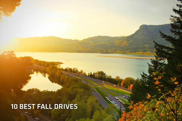

The Best Fall Drives In USA Sights Better Seen Foliage Road Trips Discover Scenic Autumn Across 44361214 SS Minnesota S Heartbreak Hill On North Shore PIN Drive Minnesotas America July 2026 Trip Routes.


Best Roads For Truck Drivers In America 2026 Horizongo Gemini Generated Image Fall Road Trips Drives Usa The Perfect Season To Upgrade Your Drive VINLAND Into Autumn Adventures Discover Scenic United States 2084489602 Most Vermont Leaf Peepers 1873593391.